| << Previous | Learning Trail | Contents | Section 2: Wells | Next >> |
| StrataBugs Learning Trail | Section 2: Wells |
Working with outcrops
You can enter and display data from outcrops just as easily as well data.
There are three main steps:
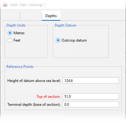
- When you add a new 'well', set its type as outcrop on the Details tab of the Well: Add/Edit dialog. On the Depths tab relate the datum of the section to sea level.
- Enter all the samples with the type 'outcrop' in the Samples module. Record sample elevations (rather than depths), as positive numbers. Use a negative number for samples below the datum if required. You could use false numbers to order the samples correctly. You can enter a sample label (e.g. the sample collection number or location) as well if you wish and display this on a chart instead of or as well as the sample elevation.
- For charts, enter the top and base depths of the section as positive numbers.
Page last updated: 06-Oct-2022