| << Previous | Learning Trail | Contents | Section 2: Wells | Next >> |
| StrataBugs Learning Trail | Section 2: Wells |
Well: Add/Edit dialog
Use this dialog to enter the well header information. Mandatory fields are shown in red. All other fields are optional.
Details Tab
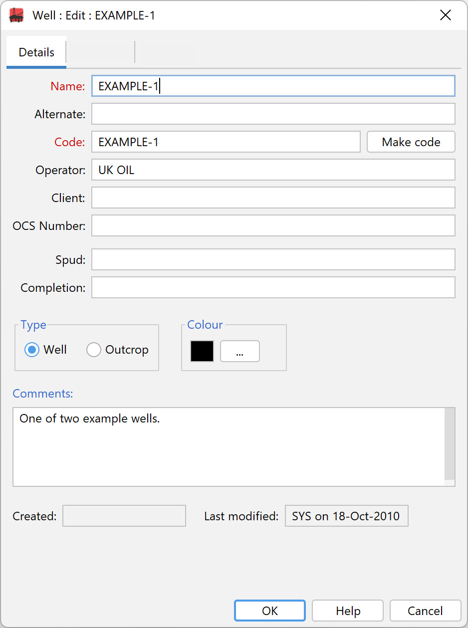
The Name and Code fields are mandatory. The well name can contain upper and lower case characters, special characters, and numbers. The well code field can contain an identical entry, or a code from a company or country coding scheme e.g. API number. The well code must be unique within the database whereas the well name may be duplicated. The Alternate well name can be used in chart headers, and will be used for well searches.
The Make code button will create a suitable well code from the well name entered. If you have a Select button next to the Make code button, you may select a well from the corporate master database, which will obviate the need to enter some or all of the rest of the well header fields. See the Well Master select dialog for more information.
The OCS number is the Offshore Continental Shelf number for wells drilled in the USA.
The type of section may be Well or Outcrop. For outcrops, 'depth' values are displayed as positive elevations (although internally all values are stored as depths). More about working with outcrops...
The spud and completion fields are for dates, which should be entered in the format shown in the image above, i.e. DD-Mon-YYYY. Note that the month abbreviation is affected by your computer's language settings. StrataBugs will first attempt to parse the month in the local language, and if that fails it will attempt using English.
The colour is used in some chart elements to identify this well.
Location Tab
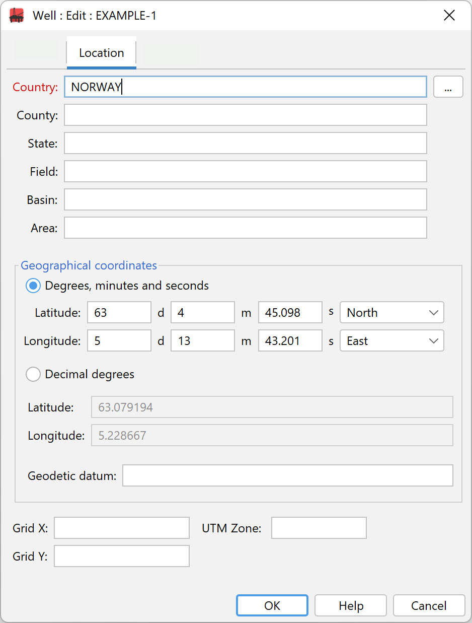
You must enter a Country. You can press the ellipsis next to the field to select from a list of all the countries that have been used in wells in your database. Remember that you can search for wells by country, so it is helpful to make sure that the spelling of country names is consistent.
Geographical coordinates (latitude and longitude) may be entered either as degrees/minutes/seconds or decimal degrees. You must enter coordinates to plot wells on a map. The Geodetic datum may be used in future to translate between coordinate reference systems. The commonly used WGS 84 datum is assumed by default; other common systems are NAD 83 and ED 50.
Grid X/Grid Y values for local coordinate systems can be entered but are not currently used in mapping.
Depths Tab
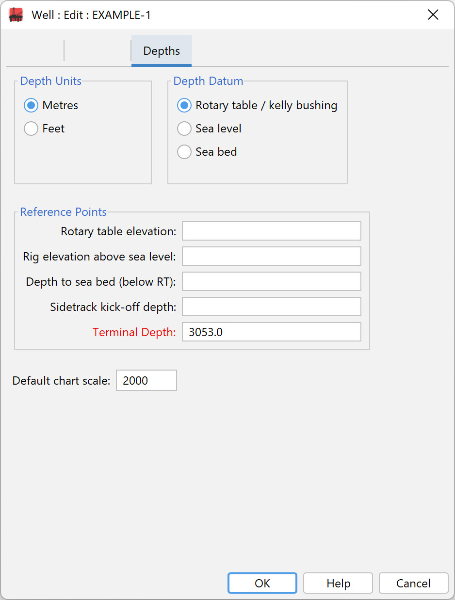
Select the appropriate Depth Units option (metres or feet).
Note: If you edit a well and change the depth units, you may be asked if you want to change the sample depths as well. Since the depths are all stored internally in metres, you will need to choose "Yes" to change the sample depths if you want the same numbers to appear in the alternative units. For example, if the well was originally in metres and you have a sample at 100m, and you change the well units to feet, select "Yes" if you want the sample to become 100', select "No" if you want the sample to remain at 100m, and therefore be displayed as 328'.
It is recommended that you visit the Understanding depths page before entering well depth data.
Select the Depth Datum from which the depths in the well or borehole are measured. The datum is used to align chart blocks.
Optionally you may enter the Reference Point of the Rotary table elevation, Rig elevation above sea level and Depth to sea bed.
Note: The Rotary table elevation will always be above the Rig elevation. The Rig elevation for offshore wells will always be Sea Level (i.e. zero); for onshore wells it will be above (and rarely below) Sea level. The Depth to sea bed is measured below the Rotary table.
For sidetrack wells enter the Sidetrack kick off depth.
You must enter a Terminal depth. If you don't know this value enter a large number which is likely to exceed the deepest sample (e.g. 9999.0m). For outcrop sections, Top of Section is a mandatory field, but terminal depth is not. You cannot add samples deeper than the terminal depth.
Page last updated: 11-Oct-2022 12:45