| << Previous | Learning Trail | Contents | Section 2: Wells | Next >> |
| StrataBugs Learning Trail | Section 2: Wells |
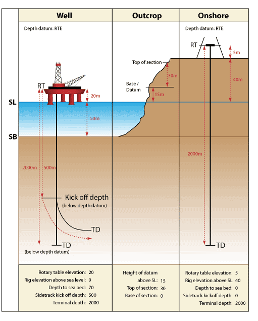
Understanding depths
The diagram below defines the different depths you can store in StrataBugs.
Note that Rotary Table Elevation is the most common, but not the only option for the depth datum.
Page last updated: 06-Oct-2022