Wells & Outcrops main window
The Wells & Outcrops module allows you to create new wells and outcrop sections, and organise wells into projects and well lists, edit well header information, and add other data which is not related to samples (such as wireline logs).
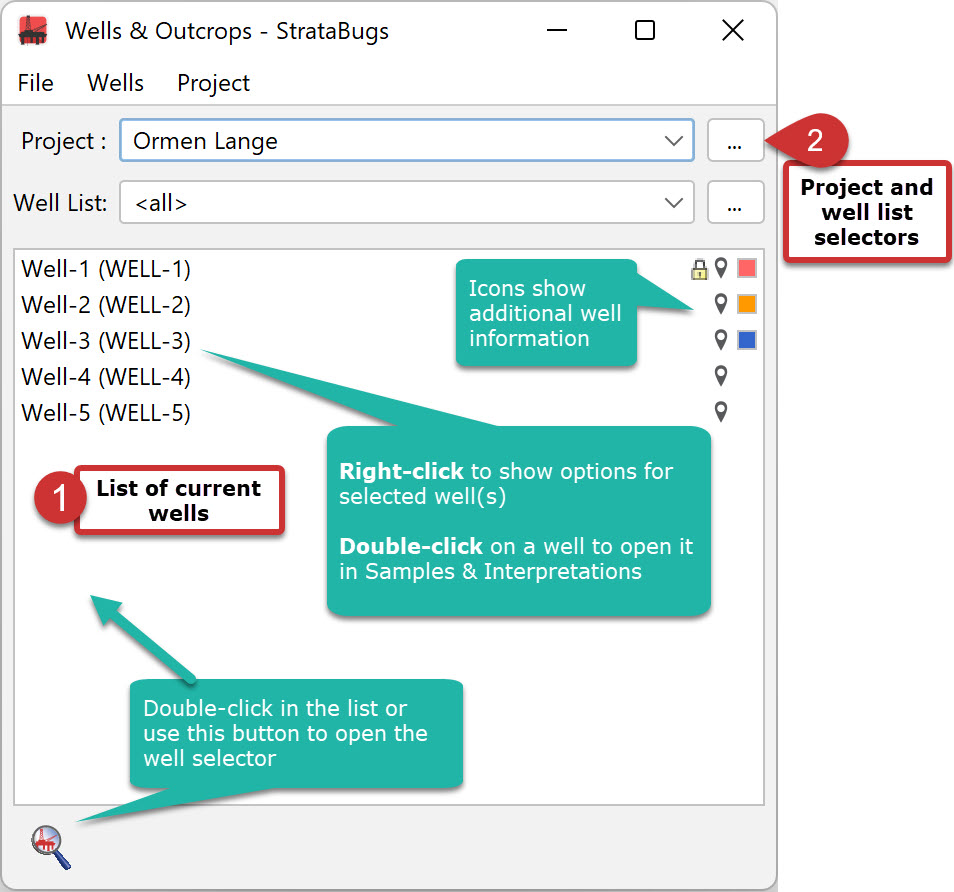 The Wells Main Window shows (1) a current working list of wells, and (2) controls to select a project and well list.
If a project well list is selected, the working list reflects the contents of that project well list, i.e. adding or removing wells will update the project.
Working with the well list
To populate the working list of wells:
Select a project and well list using the drop-down boxes. You can also use the selector buttons (...) to open the Project: Select dialog (which also enables you to add a new project).
Double-click in an empty part of the list or press the well search icon to open the Well: Select dialog, which enables you to search for and select one or more wells.
Add a new well (File > New well).
Remove a well (or wells) from the working list (and also the current project well list if selected) by right-clicking on it to show the context menu and choosing Remove from project / well list. You can also choose the same option from the Wells menu.
To save the current selection as a new well list, right-click and choose Save as well list. You must select an empty well list, which can be from any project.
Working with individual wells
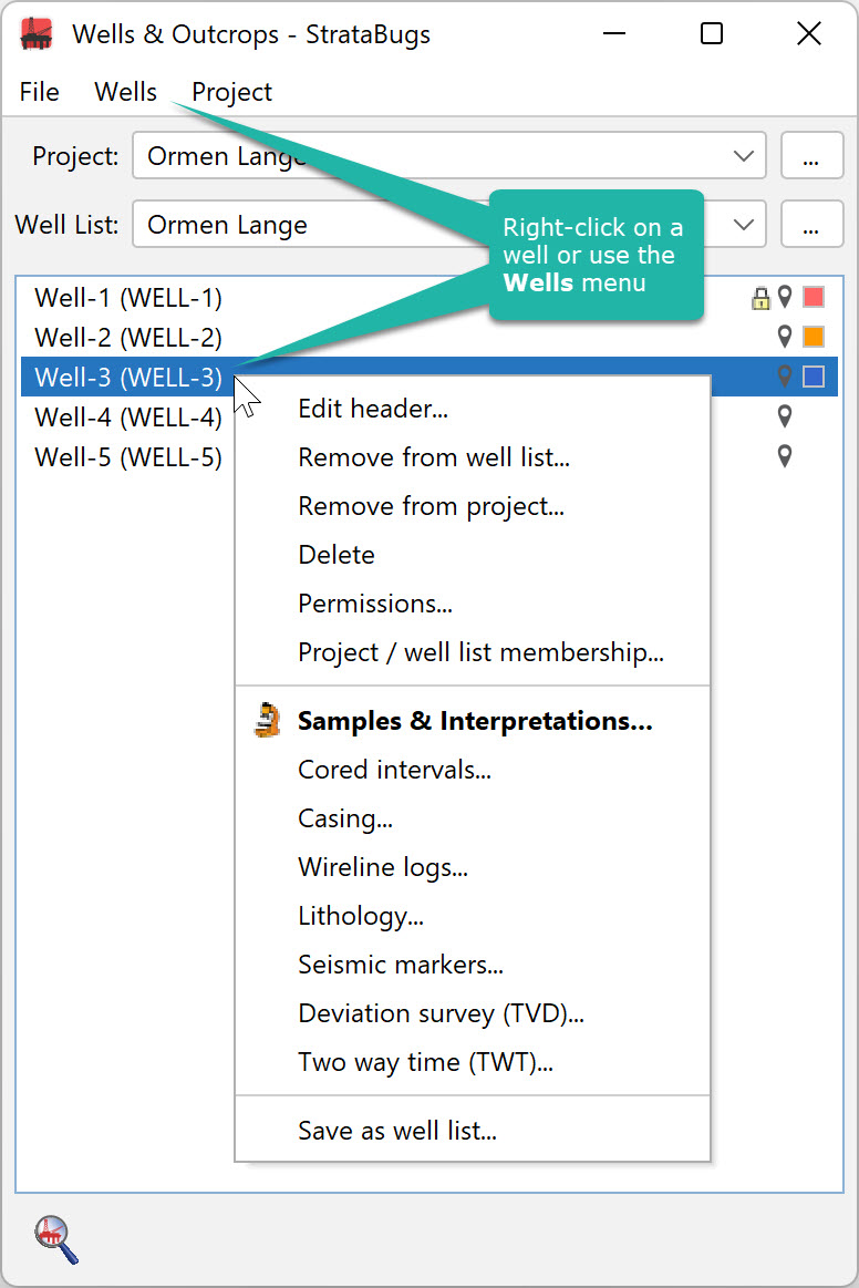 |
Select one or more wells in the list. You can use the Wells menu or right-click on your selection to see the same list of options. Some options are disabled if you have multiple wells selected. You can also double-click on a well to open it in the Samples & Interpretations module.
Edit the well header details with the Well dialog. The lower items enable editing of well data which is not related to samples. Each item opens its own dialog:
|
Project options
-
Create project database is a utility for creating a new database from an existing project. This feature is not yet enabed for v3.0.
-
Sidetrack chart is a facility for plotting projects with deviated wells. See the here for more information. This feature is deprecated in v3.0 and will later be incorporated into map blocks.
-
Export KML positions creates a simple text file (.KML) of the well positions from the selected proejct which you could use in another application (e.g. Google Earth). The well headers must include the correct coordinates.
Note: Google Earth assumes that the coordinates use the global datum standard WGS84. This is the standard currently used in GPS systems.
Page last updated: 07-Oct-2022